Getting Around Madagascar

Getting around Madagascar means choosing between a private vehicle with driver, taxi-brousse minibuses and domestic flights, and the choice shapes an itinerary more than anything else. Roads are slow, distances deceive and flights run at limited frequency. Most visitors combine a hired vehicle for the parks with flights for the long transfers, and that is usually the right answer.
Why Distances Deceive in Madagascar
The single most useful thing to understand is that map distances mean very little here. The RN7 from Antananarivo to Toliara covers roughly 950 km and takes the better part of a week with stops. Antananarivo to Antsirabe is 170 km and three to four hours.
The causes are cumulative rather than dramatic: narrow sealed roads winding through highlands, trucks on gradients, livestock, pedestrians, roadworks, and unsealed sections that reduce progress to walking pace. Averaging 40 km an hour on a good day is normal.
Beyond the sealed network it gets worse. Morondava to Tsingy de Bemaraha is 200 to 230 km and takes six to ten hours with two river ferries. Ambatondrazaka to Zahamena is 67 km and takes four hours.
Two hundred kilometres in western Madagascar can take ten hours and two river ferries. Plan by hours, never by kilometres.
Private Vehicle and Driver Hire
This is what most operators arrange and what most itineraries assume. A vehicle with a driver is charged per day rather than per kilometre, and the rate applies whether you drive eight hours or sit at a park.
The driver is worth more than the transport. Local drivers know which sections are washed out, where the ferries are running, how to handle police checkpoints and where to stop. On a trip where navigation is genuinely difficult and English-language signage is absent, this matters.
Four-wheel drive is required for the western circuit to Tsingy de Bemaraha, the Andohahela outer parcels, the Anjohibe caves, the tracks to Kirindy Mite and most remote park access. On the sealed RN7 a standard vehicle is often adequate and costs less.
Taxi-Brousse and Public Transport
Taxi-brousse minibuses connect every town in Madagascar and are how most Malagasy people travel. They depart when full rather than to a timetable, cost a fraction of private hire and take considerably longer.
They work well on the RN7 corridor, the RN2 east and the RN6 north, where the road is sealed and services are frequent. Independent travellers use them routinely and the experience is a genuine part of seeing the country.
The limitation is reaching the parks themselves. Ranomafana sits off the RN25, Anja is a short hop from Ambalavao, and Andasibe’s entrance is beyond the village. Drop-offs leave you with a further taxi or a walk, and returning after a full-day circuit can be awkward. Many independent travellers use taxi-brousse between towns and hire a vehicle for park legs.
Private vehicle and driver. Flexible, comfortable, reaches everywhere, driver handles navigation and checkpoints. The dominant cost on most trips, charged daily regardless of distance. Necessary for the west and remote parks.

Taxi-brousse. Very cheap, frequent on main corridors, an authentic experience. Slow, crowded and departs when full. Awkward for reaching park entrances. Best combined with local hire for the final legs.
Domestic flights. Saves one to three days per long transfer and is the only practical route to Maroantsetra, Sambava and Fort Dauphin. Limited frequency, sells out in peak season, reschedules. Book first.
Domestic Flights and Route Planning
Flights connect Antananarivo to Nosy Be, Diego Suarez, Sambava, Maroantsetra, Toamasina, Morondava, Toliara and Fort Dauphin. Almost every route transits the capital rather than connecting regions directly.
They matter most where the road alternative is punishing. Fort Dauphin takes around three days to reach overland and official advice recommends flying. Maroantsetra for Masoala has no practical road route. Morondava and Toliara are drivable but consume most of a week in return transfers.
Frequency is the constraint. Routes run a few times weekly rather than daily, sell out in peak season and reschedule with little notice. Book flights before accommodation, since capacity determines what itinerary is possible. Never plan an international departure on the same day as a domestic arrival.
Self-Drive and Car Rental
Self-drive is possible and some travellers do it, particularly on the RN7. Rental agencies commonly supply vehicles with drivers as standard, and hiring without one requires asking.
The arguments against are practical rather than legal. Road conditions demand experience, navigation is difficult, police checkpoints are frequent, fuel stations thin out beyond the main routes and breakdown assistance is limited. A local driver typically costs less than the time and stress saved.
Anyone self-driving should carry an international driving permit, avoid night driving absolutely, and plan fuel stops rather than assuming availability. Four-wheel drive is needed for anything off the sealed network.
Boats, Ferries and Pirogues
Water transport is unavoidable in several places. The ferry from Soanierana Ivongo to Île Sainte-Marie takes around two hours across water that is frequently rough and is sometimes cancelled outright.
Nosy Be is reached by boat from Ankify on the mainland or by air. Masoala and Nosy Mangabe are reached only by boat from Maroantsetra, one to two hours depending on sea conditions, and crossings cancel in rough weather.
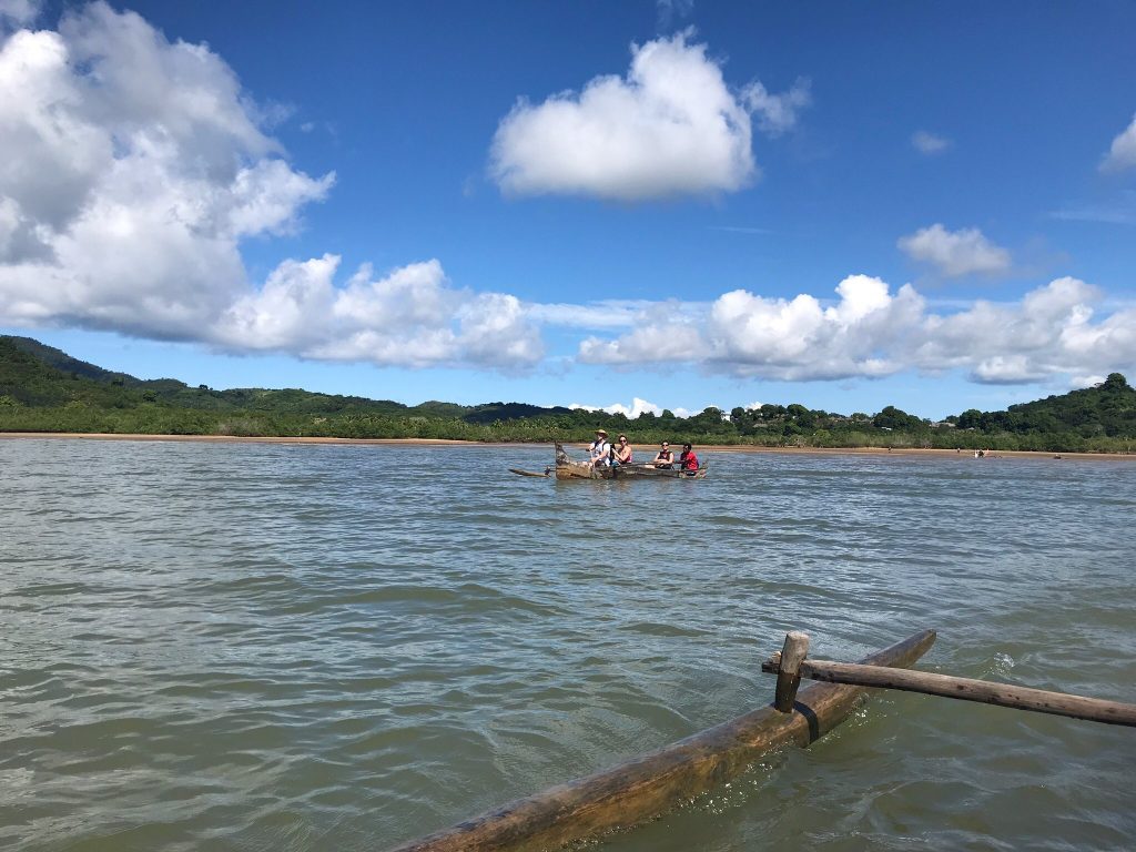
The western route to Tsingy de Bemaraha involves two vehicle ferries, one departing when enough vehicles gather rather than to schedule, and the Manambolo crossing at Bekopaka running only until early evening. Missing it means a night on the wrong side.
Build buffer days into any itinerary depending on boats. Sea crossings to Sainte-Marie, Masoala and Nosy Be all cancel in rough conditions, and the western ferries run to their own logic. A schedule with no slack will break, and the day you lose is usually the one you had allocated to the thing you came for.
The FCE Railway and Rail Travel
Madagascar’s passenger rail network is minimal, and the one line worth knowing is the Fianarantsoa-Côte Est, running 163 km down the eastern escarpment to Manakara through 48 tunnels and 67 bridges.
It departs at seven in the morning, usually Tuesdays and Saturdays, and takes anywhere from twelve to twenty-four hours. Breakdowns are common and the rolling stock is in poor repair.
Treat it as an experience rather than transport. The descent through rainforest and the village stations where whole communities turn out to trade are genuinely memorable, and nobody with a flight to catch within two days should attempt it.
Fuel, Checkpoints and Practicalities on the Road
Fuel stations are frequent on the RN7, RN2 and around the cities, and thin out considerably beyond them. On the western route north from Morondava and on the tracks toward Soalala or Zahamena, drivers fill up wherever possible rather than when the gauge demands it.
Police checkpoints operate on the main roads and are routine. Carry your passport or a clear photocopy, since identification is requested, and let the driver handle the interaction. Travellers rarely need to do more than present a document.
Phone coverage follows the main roads and disappears entirely at the remote parks. There is no signal at Marojejy, Masoala, Zahamena or in most of the western circuit, which matters for anyone expecting to stay in contact or relying on a phone for navigation.
Travel times shift with the season. Roads that take six hours in September may take ten in February, and some become impassable outright. Any quoted duration assumes dry season conditions unless stated otherwise.
Local Transport in Towns
Taxis operate in all cities with fares negotiated before departure rather than metered. Agreeing the price first avoids the most common friction visitors experience.
Pousse-pousse, the hand-pulled rickshaws, are the emblem of Antsirabe and common in Toamasina and other towns. Cyclo-pousse are the pedalled version and cover longer distances. Tuk-tuks operate in Diego Suarez, Mahajanga and elsewhere.
Nosy Komba and Île aux Nattes have no roads and no vehicles at all, so movement there is on foot or by pirogue. Walking is practical in the highland towns and central Antananarivo, though the capital’s hills make short distances slower than they look.
Frequently Asked Questions
Should I hire a car and driver or use public transport?
Most visitors hire a vehicle with a driver, and on any itinerary including the west or remote parks it is required in practice. Taxi-brousse works well on the RN7, RN2 and RN6 corridors for travellers with time and flexibility. Combining the two, using public transport between towns and hiring locally for park legs, gets most of the saving without the worst of the awkwardness.
What does transport cost?
Vehicle hire with driver is charged per day and is the dominant cost on most Madagascar trips, with four-wheel drive noticeably more than a standard car and fuel additional. Taxi-brousse fares are minimal, in the region of 10,000 to 15,000 Ariary for typical inter-town runs. Domestic flights add several hundred dollars per leg. One documented four-week trip for two spent around £3,454 on vehicle hire against £675 on accommodation.
Are domestic flights reliable?
Reasonably, though frequency is limited and rescheduling happens. Routes run a few times weekly rather than daily and sell out in peak season. Book them before accommodation, since capacity constrains what itinerary is possible, and always leave a buffer day before an international departure.
Can I drive myself?
Yes, though most rental agencies supply cars with drivers as standard and hiring without one requires asking. Road conditions, navigation difficulty, frequent checkpoints and limited breakdown assistance make a local driver good value rather than a luxury. Never drive at night, and carry an international driving permit.
How long does the RN7 take?
The full route from Antananarivo to Toliara covers roughly 950 km and needs the better part of a week with park stops. Antananarivo to Antsirabe is three to four hours, Antsirabe to Ranomafana six to eight. Plan by hours rather than kilometres and expect averages around 40 km an hour.
Is the taxi-brousse safe?
It is how the country travels and fine for the most part, though vehicles are crowded, often overloaded and maintenance varies. Travel by day, keep bags with you rather than on the roof where possible, and avoid the very cheapest operators on long routes. Night services are best avoided entirely.
Do I need a four-wheel drive?
For the western circuit to Tsingy de Bemaraha, the outer parcels of Andohahela, the Anjohibe caves, Kirindy Mite and most remote park access, yes. On the sealed RN7 a standard vehicle is usually adequate and costs less. Booking four-wheel drive for a route that does not need one is a common way to overspend.
How do I reach the islands?
Nosy Be by air or by boat from Ankify. Île Sainte-Marie by air from the capital or ferry from Soanierana Ivongo, the latter often rough and sometimes cancelled. Masoala and Nosy Mangabe only by boat from Maroantsetra. Nosy Komba, Tanikely and Iranja by boat from Nosy Be. Build slack around all sea crossings.
Planning Your Trip
Transport is the constraint that shapes every Madagascar itinerary, and the two decisions that matter are which legs to fly and how many vehicle days the route needs. Get those right and the trip works; get them wrong and you spend the holiday looking out of a windscreen.
Booking Your Madagascar Trip
The safari companies and tour operators listed on this website put trips like this together for a living and know which camps, guides and routes actually deliver. We are an independent guide to Madagascar; we do not book or sell tours ourselves.
When you are ready, arrange your safari, tour or holiday with one of the recognised operators listed here. Tell them your dates and what matters most, and a real person, not a form, will handle the itinerary, park bookings and logistics for you.