Andringitra National Park
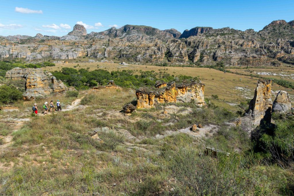
Andringitra National Park holds Pic Boby, at 2,658 metres the highest summit in Madagascar that ordinary walkers can reach, along with granite domes, high grassland and ring-tailed lemurs living above the treeline. Treks run from a single day to four days between camps, and the classic Imarivolanitra circuit takes three. The park covers 31,160 hectares south of Ambalavao and belongs to the UNESCO-listed Rainforests of the Atsinanana.
Pic Boby Trekking Safaris to the Roof of Madagascar
A Pic Boby trekking safari is the reason most people come to Andringitra. The peak carries two names. Malagasy speakers call it Imarivolanitra, meaning close to the sky. The other name belongs to a dog: geologists who made the first recorded ascent in 1956 brought an animal called Boby along, and the name stuck.
Maromokotro in the far north is higher at 2,876 metres, but reaching it involves a serious expedition through remote country. Pic Boby is the summit you can walk up, and the walking is genuinely manageable. From the plateau camp the ascent takes two to three hours on rock and grass with no technical sections at all.
The summit push starts around three in the morning if you want to be on top for sunrise, which is the point. Cloud builds through the day and by mid-morning the view has usually gone. Get it right and you look across the whole massif, with the Isalo formations visible on the southwestern horizon on the clearest days.
This is the coldest ground in Madagascar. Temperatures on the plateau drop below freezing at night and frost is normal. Bring a proper sleeping bag, insulated layers and gloves. Visitors who pack for a tropical island and arrive expecting one have a bad night at 2,000 metres.
The Imarivolanitra Circuit and Multi-Day Andringitra Trekking
The Imarivolanitra circuit is the standard multi-day trek, running roughly 28 km over three days with five to six hours of walking each day. It crosses grassy savanna, climbs to the summit and descends the western slope toward Tsaranoro through terrain that guides and trekkers alike describe as lunar.
Elevation gains and losses of around 500 metres are routine across the route. The walking is sustained rather than brutal, and occasional hikers manage it. Four-day versions add a night and slow the pace, ending in the Tsaranoro Valley rather than returning the way you came.
Shorter options exist for anyone without three days. Diavolana and Isahavato are two-day routes. Asaramanitra runs about 6 km and Imaitso about 14 km, both walkable in a day, the latter through the eastern rainforest belt.
Rock Climbing Adventures in the Tsaranoro Valley
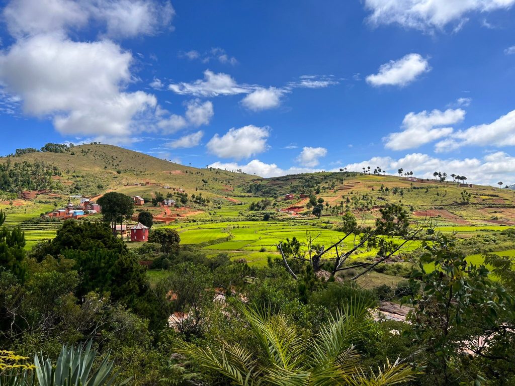
The Tsaranoro Valley sits on the western side of the massif and is the centre of rock climbing adventures in Madagascar. Sheer granite faces rise straight out of rice terraces, and the walls here have an international reputation among big-wall climbers.
Chameleon Peak is the accessible objective, climbed by many trekkers as an add-on rather than a technical route. The valley is outside the national park boundary, so park fees do not apply, though a small community fee goes to the local villagers’ association that manages the area.
The atmosphere down here differs sharply from the plateau. Drier and more open, with a savanna feel at the foot of the cliffs, it makes a natural finish to a trek that started in cold high grassland.
High-Altitude Ring-Tailed Lemur Watching Tours
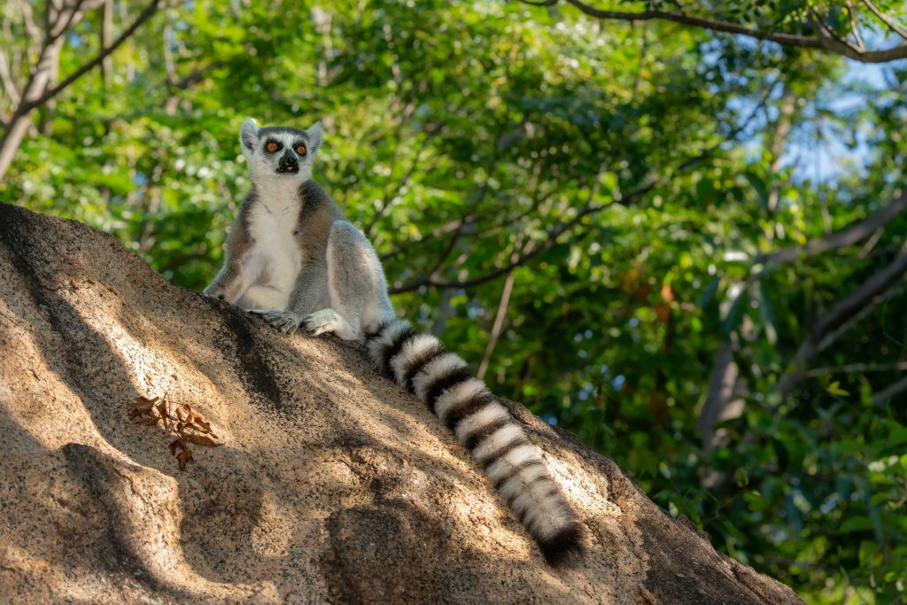
Ring-tailed lemur watching tours at Andringitra offer something no other park can. Ring-tailed lemurs are a species of dry southern forest and spiny scrub at low altitude, or so the textbooks had it. A survey of the summit zone recorded them above the treeline at 2,520 metres, among exposed rock and subalpine heath.
The animals up here look different. Their fur is denser and woollier, their colour darker, and their tails carry fewer dark rings than lowland ring-tails. That difference was striking enough that researchers ran genetic tests to see whether this was an undescribed species. It is not, but the population remains one of the odder pieces of lemur ecology in Madagascar.
Ring-tailed lemurs living above the treeline in country that freezes at night, on a massif where the same park protects rainforest sifakas a few thousand metres below.
At least nine lemur species live across the altitude range, including Milne-Edwards’ sifaka, golden bamboo lemur, grey bamboo lemur and the very rare grey-headed lemur. Wildlife is not the main draw here in the way it is at Ranomafana, and visitors who come only for lemurs sometimes leave disappointed.
Diavolana and Asaramanitra Day Hiking Tours
Day hiking tours suit travellers passing along the RN7 without the days for a summit trek. Asaramanitra is the short one, roughly 6 km, taking in waterfalls and pools in the Namoly Valley where swimming is possible.
The Imaitso trail runs about 14 km through the eastern rainforest, which is where lemur sightings are most likely and where the park feels least like a mountain and most like the rest of Madagascar. Diavolana can be walked as a long day or split across two with a camp.
Birding Tours Across the Andringitra Altitude Bands
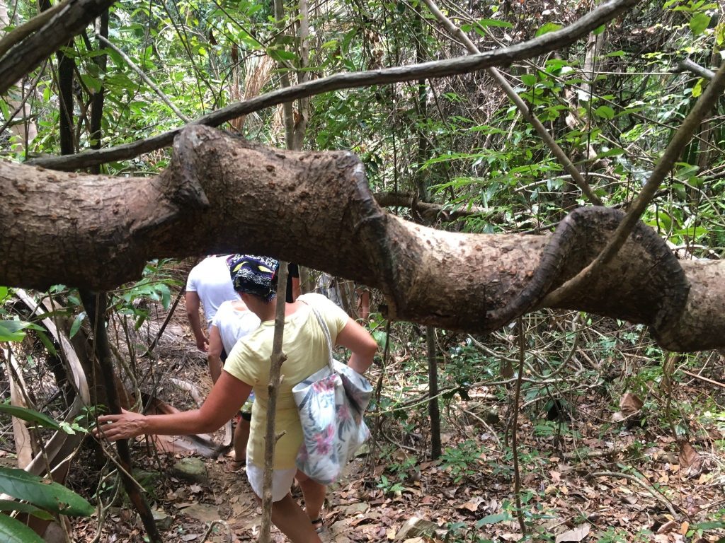
Birding tours here work differently from the rainforest parks because the massif stacks several habitats on top of each other. Over 100 bird species have been recorded, and which ones you see depends almost entirely on your elevation.
Rainforest species occupy the lower eastern slopes. Higher up, in ericaceous scrub and open grassland, the community shifts to raptors and open-country birds, with Madagascar buzzards and harriers working the thermals above the plateau. Ground rollers, sunbirds and Madagascar blue pigeons turn up in the forest bands.
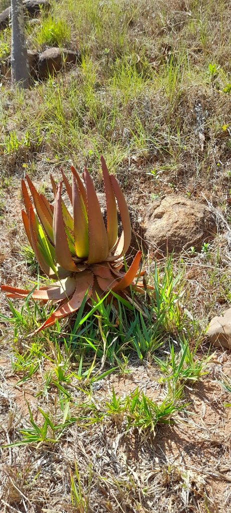
The plants are worth as much attention as the birds. Above 2,000 metres the ground carries tussock grasses, tree heathers and everlasting flowers, an assemblage with more in common with African mountains than with anywhere else on the island.
Camping Trips and Trail Logistics Inside Andringitra
Multi-day camping trips use five sites maintained by Madagascar National Parks along the trekking routes. Each has dry toilets and washing facilities. None has showers, and nobody should arrive expecting them.
Collecting firewood inside the park is prohibited unless bought from authorised vendors, so cooking arrangements need sorting in advance with your guide. Most trekkers hire porters at the trailhead, which transforms the experience if you are carrying camping gear and several days of food.
Guides are compulsory. Porters and cooks are optional but standard, and the village economies around both entrances depend heavily on that work.
Getting to Andringitra from Ambalavao
Ambalavao on the RN7 is the staging town, and there are two ways in. Neither is quick and both need a four-wheel drive.
Namoly Valley, eastern entrance. Roughly 43 km from Ambalavao on an unpaved road, about three hours. The classic start for the Pic Boby ascent, passing villages and sacred waterfalls cut into the rock. Best if you are coming from the north and skipping Tsaranoro.
Morarano, western entrance. Continue south on the RN7 past Ambalavao, then a track of 25 to 30 km, two to three hours. Reaches the Tsaranoro Valley and the climbing walls. The choice for climbers and for anyone walking the circuit south to north.
Most trekkers walk the circuit from Namoly and finish at Morarano, which means arranging a vehicle to meet them at the far end rather than doubling back. Accommodation clusters in the Tsaranoro Valley around Andonaka, with lodges and camps at a range of standards. Ambalavao itself has simple hotels and is where you buy supplies.
Best Time for an Andringitra Trek
Andringitra is walkable through most of the year, with cyclones the main interruption. The variable that matters is cold rather than rain, which reverses the usual Malagasy calculation.
April to June. Rains have eased, the grassland is still green and daytime walking is comfortable. Nights are cooling but not yet at their worst. A strong window for the full circuit.
July and August. Driest and clearest, with the best summit views, but also the coldest. Sub-zero nights on the plateau are routine and frost is common. Serious sleeping gear required.
September to November. Many trekkers’ preference. Warming nights, reliable trails, flowering plants across the high grassland and long clear mornings before the cloud builds.
December to March. Wet and prone to cyclones, which close the routes outright when they come through. Trails stay technically open between storms, but the summit is often in cloud and the roads in deteriorate.
Frequently Asked Questions
How much does it cost to trek in Andringitra?
Park entry is 45,000 Ariary per adult per day, with children under twelve at 25,000 Ariary, charged for each day inside. Guides are compulsory and priced by circuit. Porters and cooks are extra and worth budgeting for on a multi-day trek. The Tsaranoro Valley sits outside the park and charges no entry fee, though a community fee of around 10,000 Ariary per person goes to the villagers’ association. Everything is cash in Ariary, and Ambalavao is the last place to draw money.
How fit do I need to be for Pic Boby?
Moderately fit rather than exceptionally so. The circuit involves five to six hours of walking a day with repeated ascents and descents of around 500 metres, and the summit climb itself is a two to three hour walk on rock with no technical difficulty. Altitude is not high enough to cause problems for most people. The cold and the early starts trouble visitors more than the gradient.
How cold does it actually get?
Cold enough for frost. The plateau records the lowest temperatures in Madagascar and nights below freezing are normal in the dry season. A three-season sleeping bag at minimum, insulated jacket, hat and gloves. Many trekkers underestimate this because they have packed for the rest of the country.
Is Pic Boby the highest mountain in Madagascar?
No, it is the second highest. Maromokotro in the Tsaratanana massif reaches 2,876 metres, but getting there is a remote expedition rather than a trek. Pic Boby is routinely described as the highest accessible summit, which is the accurate framing.
How many days should I allow?
Three days and two nights is the classic circuit and suits most trekkers. Four days slows the pace and finishes in the Tsaranoro Valley. Day walkers passing on the RN7 can do Asaramanitra or Imaitso in a single day from Namoly, though that misses the summit entirely.
Can I combine Andringitra with other parks?
Easily. It sits on the RN7 corridor between Ranomafana to the north and Isalo to the south, which makes it a natural insert into a southern circuit. Ambalavao is also the base for the Anja Community Reserve, a short stop with reliable ring-tailed lemur sightings at low altitude.
Is Andringitra good for wildlife?
It is good for a specific kind of wildlife rather than for volume. The high-altitude ring-tailed lemurs are genuinely unusual and the plant communities are exceptional. If you want dense lemur sightings, Ranomafana further north on the same road delivers far more. Come here for the mountain.
Planning Your Visit
The two decisions that shape an Andringitra trek are which entrance you start from and whether you have arranged a vehicle at the other end. Walking the circuit one way and getting collected at Morarano is much better than an out-and-back, but it only works if someone is there.
Booking Your Madagascar Trip
The safari companies and tour operators listed on this website put trips like this together for a living and know which camps, guides and routes actually deliver. We are an independent guide to Madagascar; we do not book or sell tours ourselves.
When you are ready, arrange your safari, tour or holiday with one of the recognised operators listed here. Tell them your dates and what matters most, and a real person, not a form, will handle the itinerary, park bookings and logistics for you.